Border geoportal
Data Content
Basic and reference data of the Geoportal
The following table shows some base and reference data that are initially proposed for the Geoportal:
Reference Data
- Geodetic reference frame
- Coastlines
- Administrative limits: international, state and municipal
- Hydrologic limits: watersheds and regions
- Hydrography
- Relief
- Roads
Basic Data
- Geology
- Soils
- Land use and Vegetation
- Weather
Scale of the data
The Geoportal will generally adhere to the following scale and extent of dataset coverage:
-
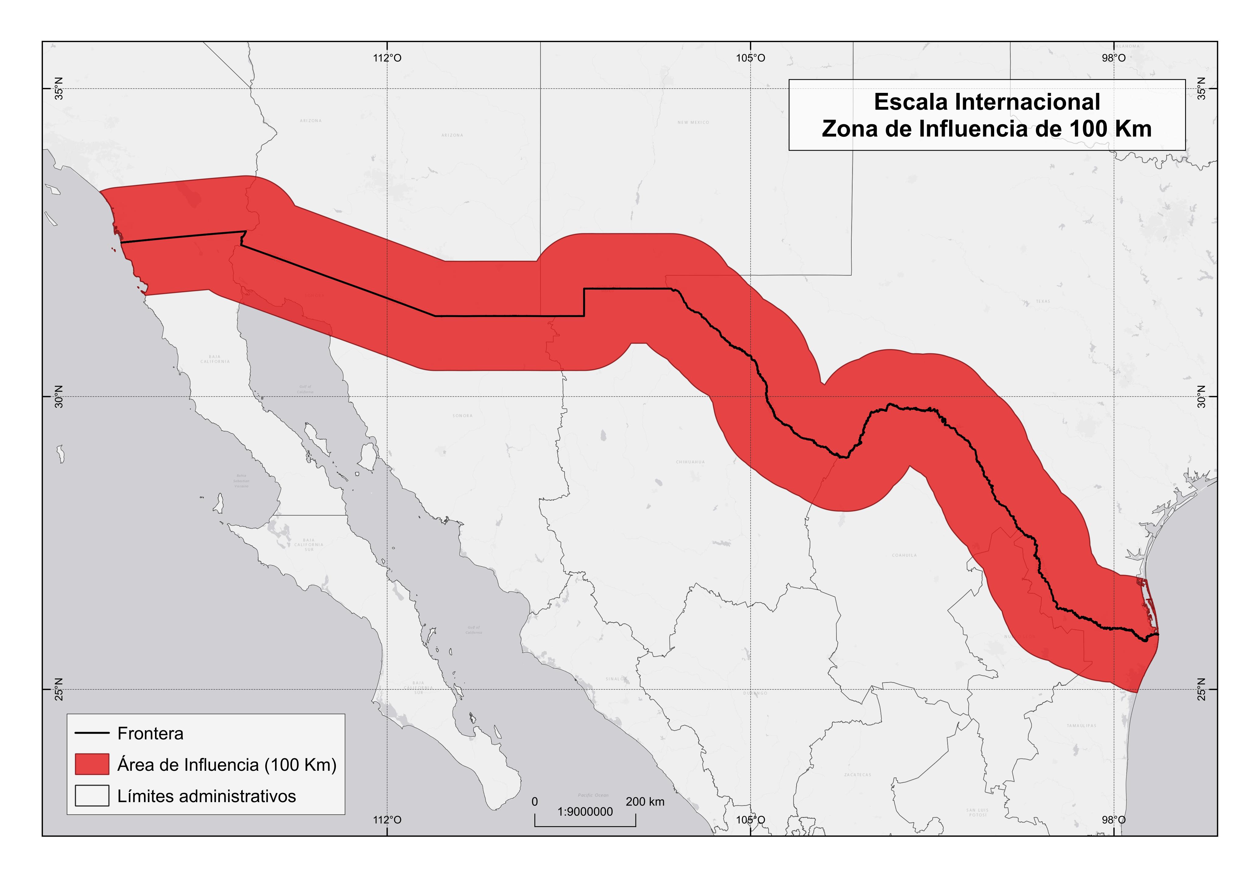 International: From the Atlantic coast to the Pacific coast with an area of influence of 100 km on each side of the common border.
 -
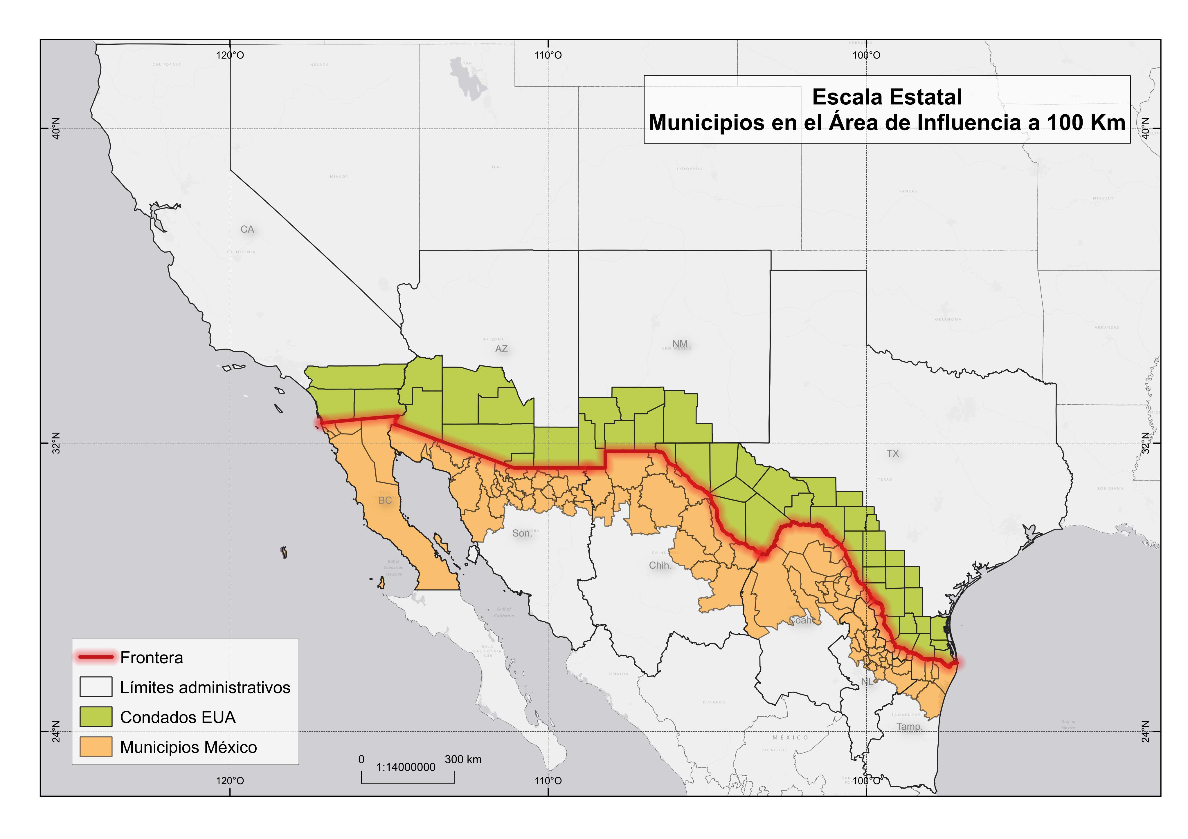 States: California, Arizona, New Mexico and Texas, on the US side (with 48 counties), and Baja California, Sonora, Chihuahua, Coahuila, Nuevo Leon and Tamaulipas of Mexico (with 94 municipalities).
 -
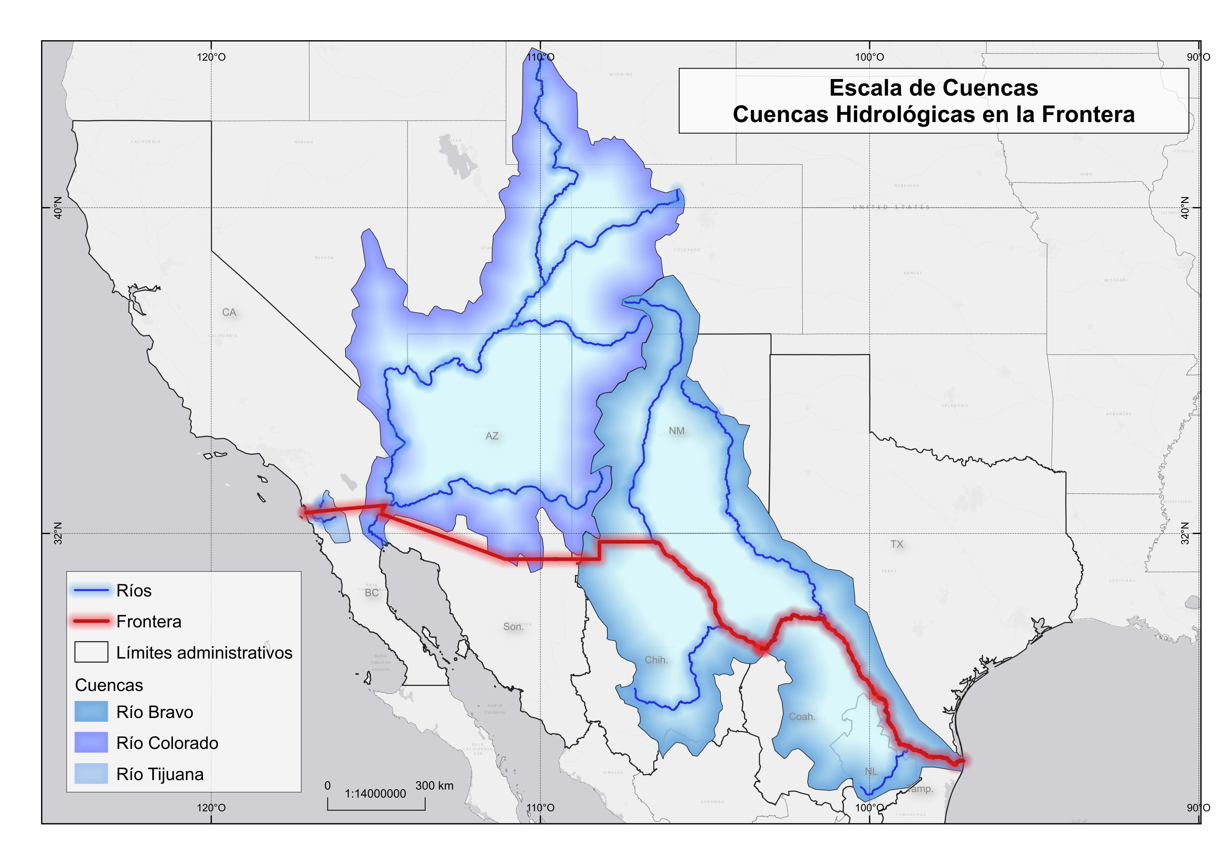 Hydrologic Basins: Rio Bravo, Colorado River, Tijuana River.
Dataset scales for each type of coverage will be defined according to the scale of the existing data. As the Geoportal is multi-scalar in nature, a data dictionary, documentation and metadata will be defined for each dataset (for example Rio), and will include attribute information for each scale.